Southern Oregon’s best-kept waterfall secret — four spectacular falls, one short drive, all before lunch
If you’re searching for the best waterfall day hike in Southern Oregon, look no further than the small community of Prospect in Jackson County. Tucked into the forested volcanic highlands of the upper Rogue River corridor along the iconic Rogue-Umpqua National Scenic Byway, Prospect is an unassuming town with an outsized natural treasure: four remarkable waterfalls within walking distance of each other, combining for one of the most rewarding half-day waterfall outings in the entire Pacific Northwest.
We’re talking about Pearsoney Falls, Prospect Falls, Mill Creek Falls, and Barr Creek Falls — four completely different waterfall personalities ranging from an intimate 12-foot horsetail to a thundering 240-foot double-tiered plunge into the Rogue River Gorge. Combined into a single visit, this is the kind of waterfall experience Oregon is famous for.
Best of all? The parking is free, the trails are short, and Crater Lake is less than 40 miles away if you want to keep the adventure going.
Where Is Prospect, Oregon?
Prospect sits on Highway 62, the Crater Lake Highway, approximately 50 miles northeast of Medford and 35 miles southwest of Crater Lake National Park. The drive from Medford takes about an hour; from Ashland or the I-5 corridor, plan for 60–75 minutes.
From Medford, take Highway 62 northeast through Eagle Point and Shady Cove. After the tiny community of Prospect, watch for Mill Creek Road on your right — that’s where most of the waterfall magic happens.
GPS for the main parking area: 42.7414°N, 122.4953°W (Mill Creek Falls Trailhead on Mill Creek Road)
The Waterfalls: What to Expect
1. Pearsoney Falls — The Charming Opener
Height: ~12 feet | Trail: 0.25 miles from upper trailhead | Difficulty: Easy
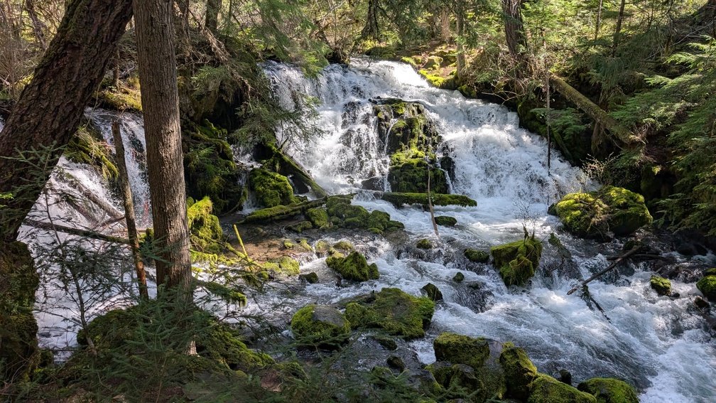
Pearsoney Falls is the unassuming first act of this waterfall quartet — a small, pretty horsetail where Mill Creek splits around a rocky island to create a two-channel cascade. Don’t let the modest height fool you: there’s real character here. The falls were named for two pioneering families who settled the Prospect area — the Pearsons and the Mooneys — their combined names living on in this quiet cascade.
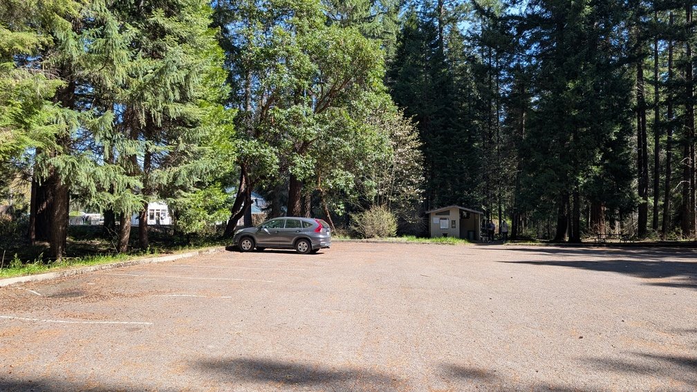
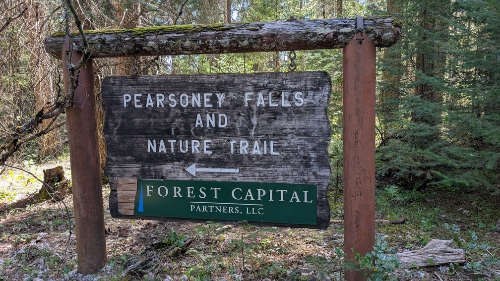
Start at the Pearsoney Falls Trailhead Parking Lot on Mill Creek Road (1.5 miles south of Highway 62). Walk upstream along the trail approximately 0.25 miles to reach Pearsoney Falls. The secondary channel may run dry in late summer, but from fall through spring both channels flow nicely through the mixed conifer and madrone forest.
Time to visit: 15–20 minutes round-trip from the parking area.
2. Prospect Falls — The Scenic Cascade
Height: ~50 feet | Trail: 0–2 miles round-trip | Difficulty: Easy-Medium
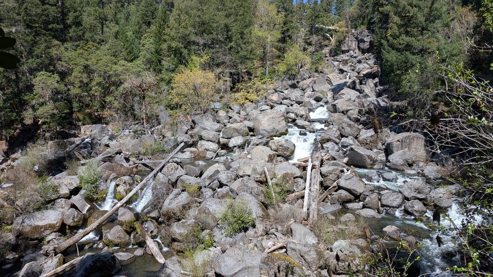
Prospect Falls is a beautiful 50-foot cascade on the upper Rogue River near the heart of the Prospect community, set in the volcanic landscape that bears the fingerprints of Crater Lake’s catastrophic eruption 7,700 years ago. The entire upper Rogue corridor was transformed by that event — pyroclastic flows, pumice deposits, and lava flows reshaped the river landscape, creating the dramatic features that make this corridor so extraordinary.
The falls flow through a forest of ponderosa pine, white fir, and incense cedar, and the easy trail provides a pleasant warm-up before the more dramatic waterfall experiences ahead.
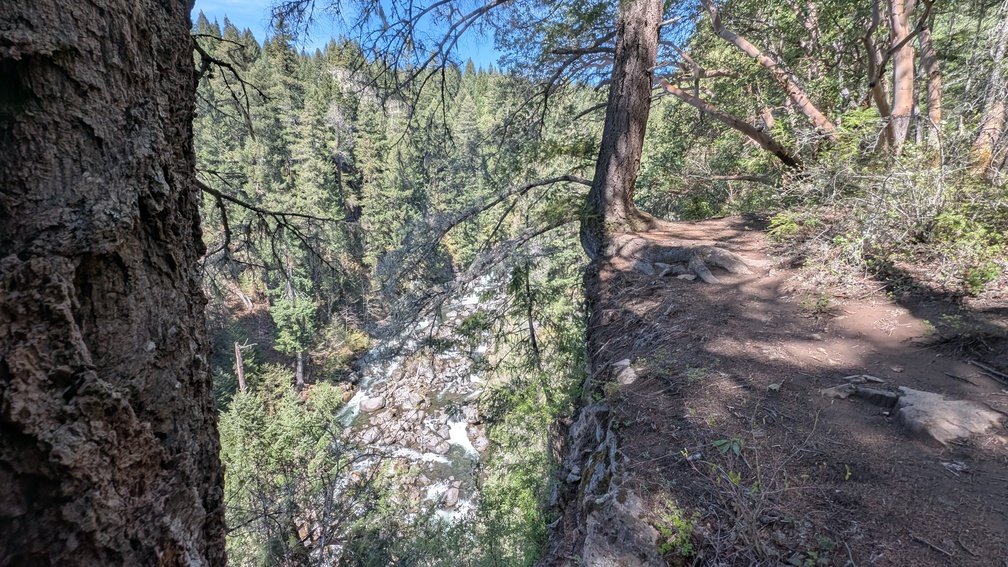
There are three ways to view Prospect Fall. You can view the top of the falls from the Avenue of the Boulders viewpoint next to the bridge across the Rogue River, park at a small pullout next to the bridge. You can also view the falls from below from the Avenue of the Boulders, however the view is mostly obstructed by boulders on the river. The third option is to continue past Pearsoney Falls on the trail for another mile where it ends at the Rogue River, this view is further away, but you get a clearer view of the entire river, boulders, bridge, and falls.
Time to visit: 45–60 minutes round-trip including the drive to the trailhead within Prospect.
3. Mill Creek Falls — Southern Oregon’s Titan
Height: 173 feet | Trail: ~1.5 miles round-trip total (to both falls) | Difficulty: Medium
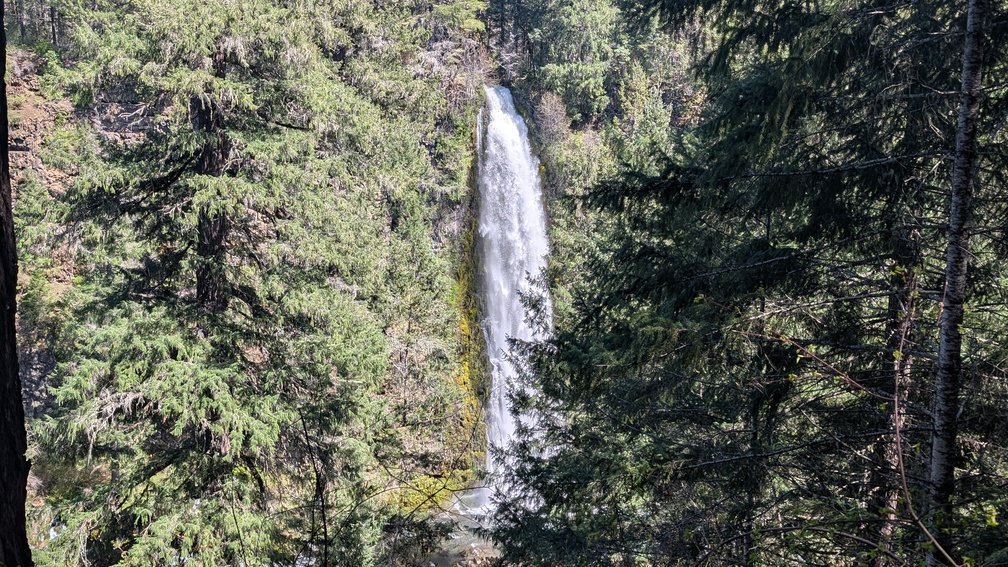
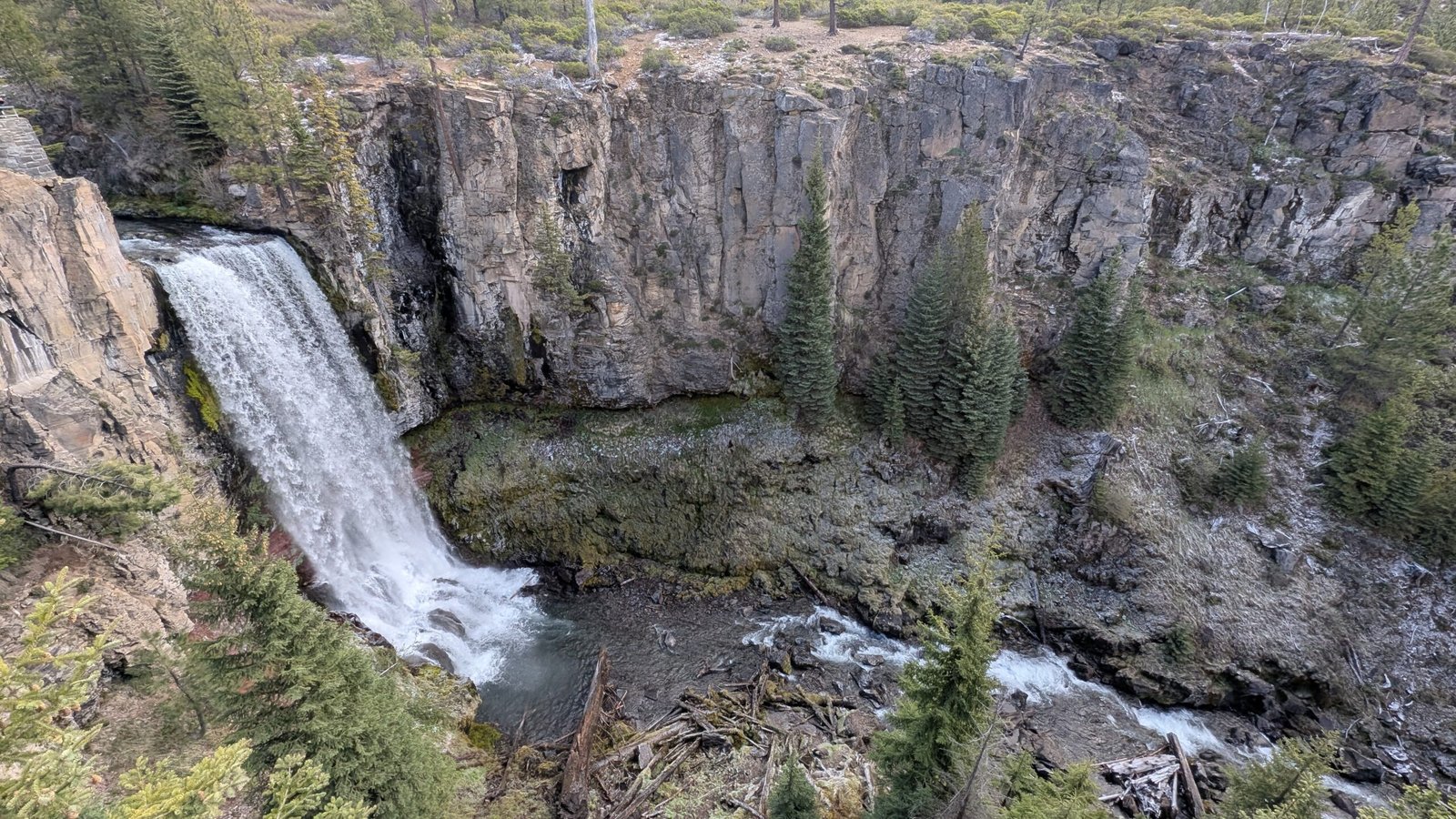
Now the day gets serious. Mill Creek Falls is a 173-foot powerhouse plunge into the Rogue River Gorge — one of the tallest waterfalls in all of Southern Oregon and, frankly, one of the most underrated tall waterfalls in the entire state. Mill Creek launches itself explosively over the cliff edge and thunders into the gorge below, generating a mist plume visible from the viewpoint and a low-frequency roar you feel as much as hear.
The Mill and Barr Creek Falls Trailhead provides a well-established trailhead with a short, descending trail through shady Douglas fir, incense cedar, and madrone forest. The path takes about 10–15 minutes to walk down, reaching a signed trail fork:
- Right fork → Mill Creek Falls and Barr Creek Falls (take this one)
- Left fork → Avenue of the Giant Boulders (visit on the way back)
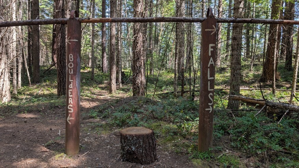
Follow the right fork a short distance to an exposed viewpoint directly across the Rogue River Gorge from the falls. The view is breathtaking — 173 feet of falls launching off a cliff face composed of petrified volcanic ash from the Mazama eruption, the river gorge walls vivid below.
⚠️ Important safety note: The viewpoints here are unguarded with steep, exposed cliff edges. Mist from the falls coats the rocks near the viewing area — they are genuinely slippery. This falls area has seen fatalities from falls. Stay back from edges, keep children and dogs close, and exercise real caution.
Time to visit: 45–60 minutes for the trail and both viewpoints.
Bonuse Viewpoint From Above Mill Creek Falls:
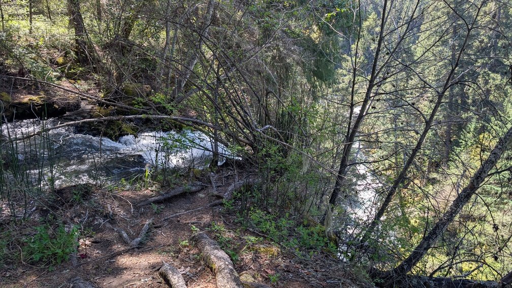
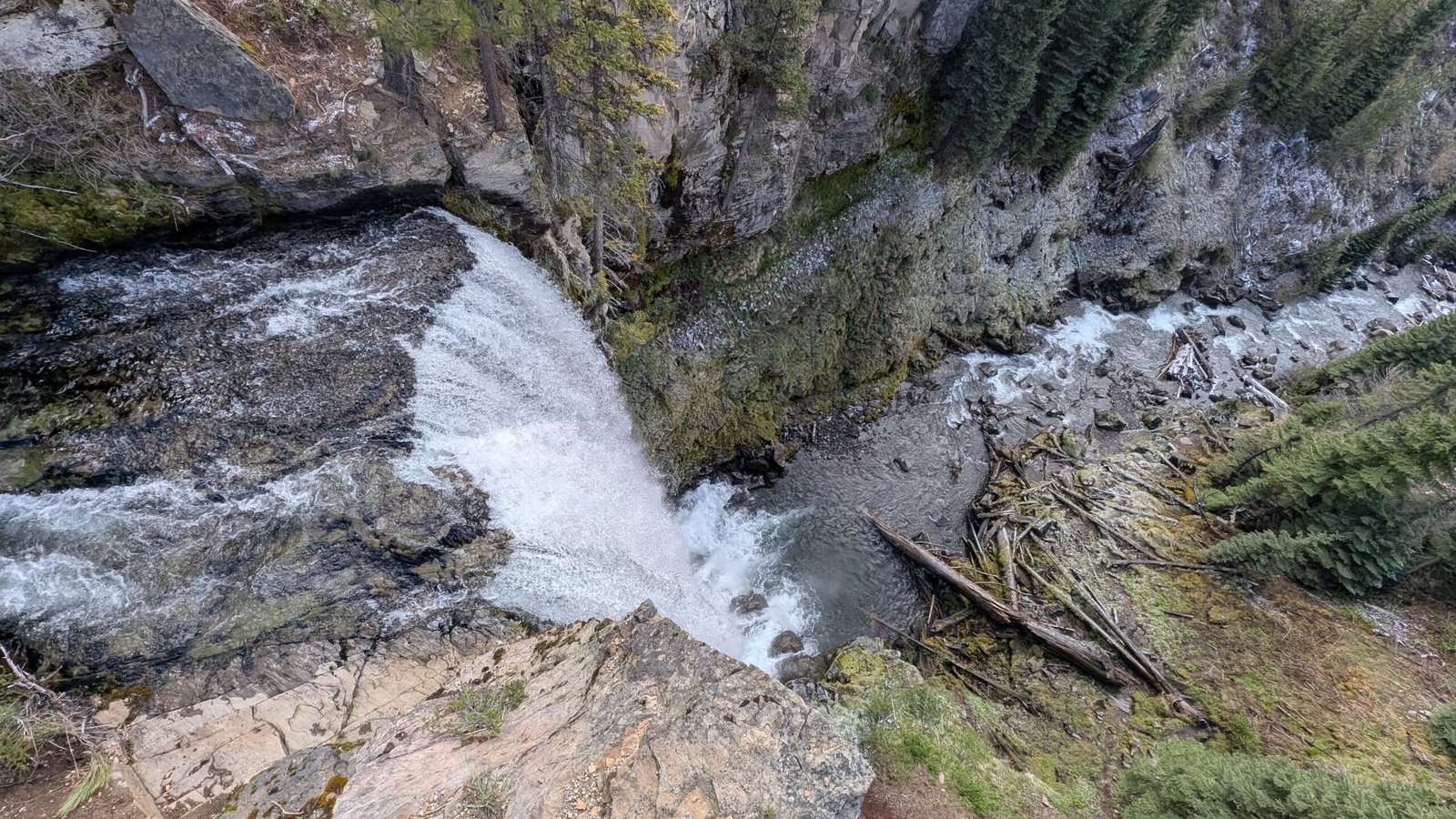
If you want a secret bonus view of Mill Creek Falls from where the creek begins to fall over the cliff, follow the Pearsoney Falls trail from it’s ending left and follow the unmarked trail along the Rogue River. This trail isn’t marked and can be difficult to follow, it’s unmaintained with fallen trees, steep sections and rocks. However the final view is well worth the slight bushwack to get here.
4. Barr Creek Falls — The Grand Finale
Height: 240 feet (two tiers) | Trail: 0.25 miles past Mill Creek Falls | Difficulty: Medium
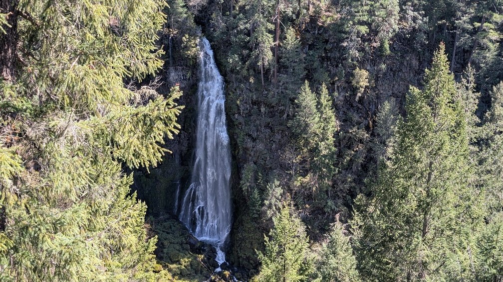
From the Mill Creek Falls viewpoint, continue just 0.25 miles further on the trail and Barr Creek Falls comes into view — a slender, two-tiered ribbon plunging 240 feet over the same cliff system as Mill Creek Falls, but in a completely different visual register. Where Mill Creek is wide and explosive, Barr Creek is graceful and refined: a long, elegant thread of white water that descends in tiers before joining the Rogue River Gorge.
The contrast between the two falls is remarkable, and the fact that you can see both from trail viewpoints just minutes apart makes this one of the finest paired-waterfall experiences in Oregon.
Barr Creek takes its name from a cattle bar — a fence built across the creek to prevent livestock from straying out of a nearby ranch — a reminder of this valley’s ranching history before the timber era transformed the landscape.
Time to visit: 15–20 minutes from the Mill Creek Falls viewpoint (included in the ~1.5-mile trail total above).
Bonus Stop: Avenue of the Giant Boulders
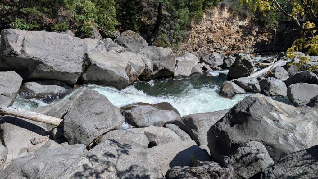
If you have time after the falls, take the left fork at the trail junction to reach the Avenue of the Giant Boulders — house-sized rocks deposited in the Rogue River canyon by the catastrophic pyroclastic flows of the Mazama eruption 7,700 years ago and later unearthed by the river’s action. You can scramble down to the river’s edge here for extraordinary close-up views of the Rogue thundering between and over these massive volcanic boulders. It adds 30–45 minutes but is absolutely worth it.
Planning Your Day Trip: The Practical Guide
Suggested Itinerary
| Time | Stop |
|---|---|
| 9:00 AM | Arrive Prospect; park at Mill Creek Falls Trailhead |
| 9:00–9:20 | Walk to Pearsoney Falls (0.25 miles upstream) |
| 9:20–10:15 | Prospect Falls (drive to second trailhead within Prospect, 1–2 mile hike) |
| 10:30–11:30 | Mill Creek Falls + Barr Creek Falls (1.5-mile trail) |
| 11:30–12:00 | Optional: Avenue of the Giant Boulders |
| 12:00–12:30 | Lunch at Beckie’s Cafe (Union Creek, 5 miles north on Hwy 62) |
| Afternoon | Optional: Natural Bridge, Crater Lake drive |
Getting There
From Medford: Highway 62 north ~50 miles to Prospect. Turn right on Mill Creek Drive (signed) in Prospect; follow 1.5 miles to the trailhead parking at road’s end. Park at the Mills Creek Trailhead Parking Lot to access Mill Creek Falls, Barr Creek Falls and Avenue of the Giants. For Pearsoney Falls, continue north over the bridge and turn right into the Pearsony Falls Trailhead Parking Lot.
From Crater Lake: Highway 62 south ~35 miles; turn left at the stopign at the intersection of hwy 230, drive past Union Creek and watch for Mill Creek Drive on your left in Prospect.
Parking and Fees
Parking is free at the Mill Creek Falls Trailhead and Prospect State Scenic Viewpoint. No day-use fee, no national forest pass required. Limited parking for approximately 10–15 vehicles.
Trail Stats Summary
| Waterfall | Height | Trail Distance | Time Estimate |
|---|---|---|---|
| Pearsoney Falls | 12 ft | 0.5 mi RT | 15–20 min |
| Prospect Falls | 50 ft | 1–2 mi RT | 45–60 min |
| Mill Creek Falls | 173 ft | 1.5 mi RT (both falls) | 45–60 min |
| Barr Creek Falls | 240 ft | included above | included above |
| Total | ~4 miles | ~3–4 hours |
When to Visit
Best season: Fall through spring for the highest water volume. The falls are dramatically powerful after winter rains or in early spring snowmelt season. That said, all four falls flow year-round, and even in summer they’re impressive — Mill Creek Falls in particular barely changes character because the Mill Creek drainage is large enough to sustain strong flows even in dry months.
Avoid: Hot summer afternoons if you’re sensitive to heat; the Rogue River gorge can funnel warm air in July and August. Morning visits are ideal year-round.
What to Bring
- Waterproof jacket or rain layer (the mist from Mill Creek and Barr Creek Falls is real)
- Microfiber cloth for camera/phone lenses
- Sturdy shoes with good grip — the viewpoint rocks near Mill Creek Falls can be slick
- Water and snacks (no facilities at the trailhead)
- Cash for lunch at Beckie’s Cafe in Union Creek
While You’re in the Area
The Prospect/Upper Rogue corridor is one of the most geologically rich and scenic areas in Oregon. While you’re here, consider adding:
- Natural Bridge (~5 miles north on Hwy 62): The Rogue River disappears completely into a lava tube and re-emerges downstream — one of the most extraordinary geological features in Oregon. Free, roadside viewpoint.
- Crater Lake National Park (~35 miles northeast): The deepest lake in the US, inside the caldera of Mount Mazama. The same eruption that created all those volcanic features around Prospect. $35 vehicle entry fee; Rim Drive open late May through October.
- Beckie’s Cafe (Union Creek): A historic roadside cafe on the National Register of Historic Places, serving excellent homemade pies and classic diner food since 1926. Don’t skip it.
- Rogue-Umpqua National Scenic Byway: The road you’re already on. Continue north on Highway 62 and connect to Highway 230 and 138 for access to Toketee Falls, Watson Falls, and the entire North Umpqua waterfall corridor.
Final Thoughts
The Prospect waterfall circuit doesn’t get the attention it deserves. There’s no Instagram queue here, no shuttles, no parking reservation system. Just four spectacular waterfalls on short trails, free parking, and the kind of volcanic landscape that reminds you Oregon is still a geologically active and extraordinary place.
Between the intimate charm of Pearsoney Falls, the scenic cascade of Prospect Falls, the raw power of Mill Creek Falls, and the elegant twin tiers of Barr Creek Falls — all within a three to four hour morning — this ranks among the best waterfall day trips in Southern Oregon, full stop.
Looking for more Oregon waterfall adventures? Explore our complete Oregon Waterfall Directory for detailed guides to all 326 waterfalls across the state.
Tags: Oregon waterfalls, Southern Oregon waterfalls, best waterfall hikes Southern Oregon, Prospect Oregon, Mill Creek Falls Oregon, Barr Creek Falls, Rogue River waterfalls, Jackson County waterfalls, Rogue-Umpqua Scenic Byway, Oregon waterfall day trip, waterfalls near Crater Lake Oregon, Prospect State Scenic Viewpoint, free waterfall hikes Oregon
Categories: Day Trips, Southern Oregon, Waterfall Guides, Hiking