
Profile
Overview
- Location: Jackson County, upper Rogue River corridor (near Prospect)
- Waterfall Type: Cascade
- Height: ~50 feet (15 m)
- Trail Distance: Visible from Avenue of the Boulders Lookout, or hike ~1–2 miles round-trip via easy trail
- Difficulty: Easy
- Best Time to Visit: Spring through fall
History & Background
Prospect Falls is a 50-foot cascade in the upper Rogue River corridor near the community of Prospect in Jackson County, part of the remarkable cluster of waterfalls and volcanic features accessible from Highway 62 along the Rogue-Umpqua National Scenic Byway. Prospect is a small historic community at the headwaters of the Rogue River, nestled in a forested valley below the volcanic highlands surrounding Crater Lake. The town was settled in 1882 and has served as a gateway to the upper Rogue’s natural attractions ever since. The Union Creek Resort nearby has operated since 1924 and represents one of the oldest continually operating resort properties in the national forest system. Prospect Falls adds to the exceptional concentration of waterfall destinations in this corridor.
Geology
Prospect Falls cascades 50 feet over volcanic rock at approximately 2,700 feet elevation in the upper Rogue River drainage. The upper Rogue watershed is shaped by the volcanic geology of the southern Cascades — including the massive eruption of Mount Mazama 7,700 years ago that deposited thick pumice layers and pyroclastic flows across this landscape, creating features like the Avenue of the Giant Boulders and the Natural Bridge nearby. The surrounding forest of Douglas fir, white fir, incense cedar, and ponderosa pine reflects the mid-elevation character of the upper Rogue.
Directions & Access
- Nearest City: Prospect, OR; Union Creek, OR (~5 miles north)
- Trail Information:
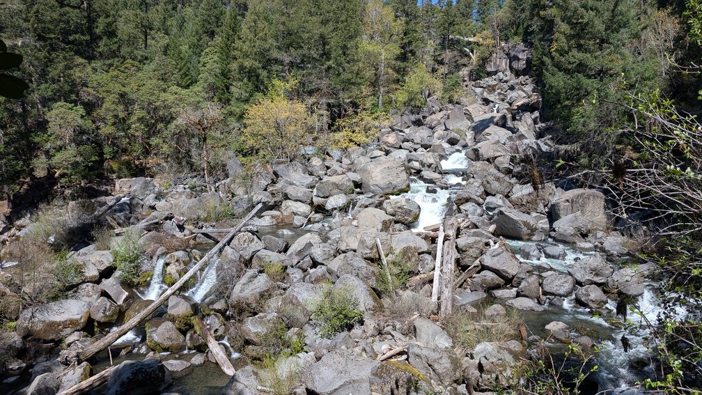
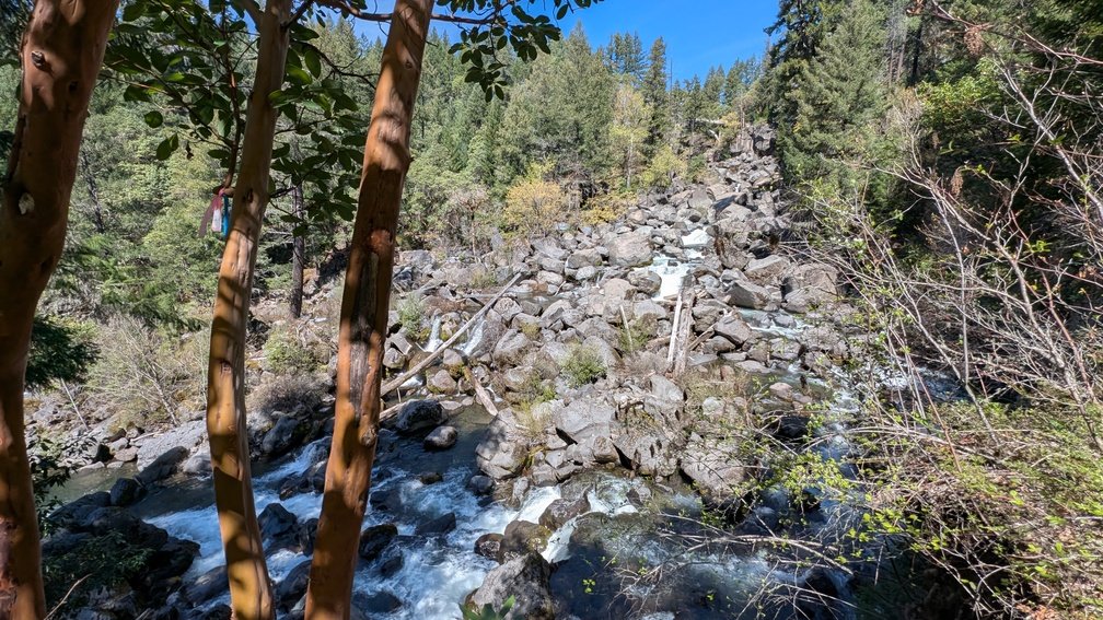
- Access via a short easy trail near the town of Prosepct, park in a small pullout near the bridge at the Avenue of the Boulders Lookout, or visit from the south via Mill and Barr Creek Falls Trailhead and head left at the fork towards Avenue of the Boulders. From this vantage point the falls are difficult to view due to the boulders obstructing most of the view, however you are very close to the bottom of the falls.
- Prospect falls are also visible, however from a further distance, from the Pearsony Falls trail. Park at the trailhead and continue past Pearsony falls headed south west. The trail ends at the Rogue River where you can see the bridge and Prospect Falls looking directly up the canyon.
- Prospect Falls can be combined with other upper Rogue destinations including Natural Bridge, Mill Creek Falls, Barr Creek Falls, and the Avenue of the Boulders for a full day of exploration on this exceptional scenic byway
- Parking:
- Small trailhead or roadside parking near the bridge directly off Mill Creek Drive; no fee.
- Accessibility:
- Short, easy trail; generally accessible for most visitors
Best Time to Visit
- Spring: Best flows from Cascade snowmelt; upper Rogue forest vivid green
- Summer: Good flows; warm and pleasant; Crater Lake 35 miles northeast
- Fall: Excellent conditions; fall color in the mixed conifer forest; clear days
- Winter: Road access generally open on Highway 62; lower flows; some snow possible at elevation
Nearby Attractions
- Natural Bridge (Rogue River lava tube)
- Mill Creek Falls (173 ft)
- Barr Creek Falls (240 ft)
- Union Creek Resort (historic)
- Crater Lake National Park (~35 miles northeast)
References
- Links:
- Books:
- Oregon Waterfalls by Greg Plumb
- Waterfall Lover’s Guide: Pacific Northwest
Map
Sorry, no records were found. Please adjust your search criteria and try again.
Sorry, unable to load the Maps API.