
Profile
Overview
- Location: Jackson County, Prospect State Scenic Viewpoint (Rogue River corridor)
- Waterfall Type: Plunge
- Height: ~173 feet (53 m) — one of the tallest waterfalls in Southern Oregon
- Trail Distance: ~1.5 miles round-trip from Mill Creek Falls Trailhead (includes Barr Creek Falls viewpoint)
- Difficulty: Medium
- Best Time to Visit: Year-round; spring and winter offer highest flows
- Daytrip: Combine into a daytrip with Pearsoney Falls, Prospect Falls, and Barr Creek Falls
History & Background
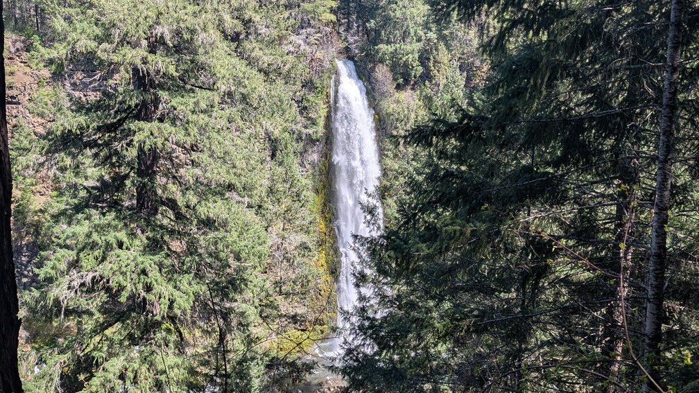
Mill Creek Falls is a thundering 173-foot plunge into the Rogue River Gorge at Prospect State Scenic Viewpoint, making it one of the tallest and most powerful waterfalls in Southern Oregon. Mill Creek drops explosively from a cliff of volcanic ash and basalt directly into the Rogue River, just a quarter mile from the equally stunning 240-foot Barr Creek Falls. The site was originally developed as a private hiking area by Boise Cascade (and later Willamette Industries) and has since become a state scenic viewpoint. The town of Prospect was settled in 1882, and the falls have likely drawn visitors since. Also accessible from the same trailhead is the Avenue of the Giant Boulders — massive rocks deposited by the catastrophic pyroclastic flows of Mount Mazama’s eruption approximately 7,700 years ago that buried the Rogue River canyon, later unearthed by river action. Caution is warranted: viewpoints are unguarded with steep cliffs that have resulted in deaths, and mist near the falls can make surfaces extremely slippery.
Geology
Mill Creek Falls drops 173 feet from a sheer cliff of petrified volcanic ash — pyroclastic deposits from the eruption of Mount Mazama that created Crater Lake approximately 7,700 years ago — into the Rogue River Gorge at approximately 2,365 feet elevation. Both Mill Creek Falls and adjacent Barr Creek Falls plunge over the same volcanic cliff, the two side by side yet distinct in character: Mill Creek is powerfully wide while Barr Creek is a slender ribbon. The Avenue of the Giant Boulders nearby displays the scale of the Mazama eruption’s deposits, with house-sized boulders deposited in the river canyon and later exposed by erosion.
Directions & Access
- Nearest City: Prospect, OR; Medford, OR (~50 miles west via Hwy 62)
- Trail Information:
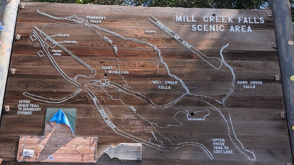
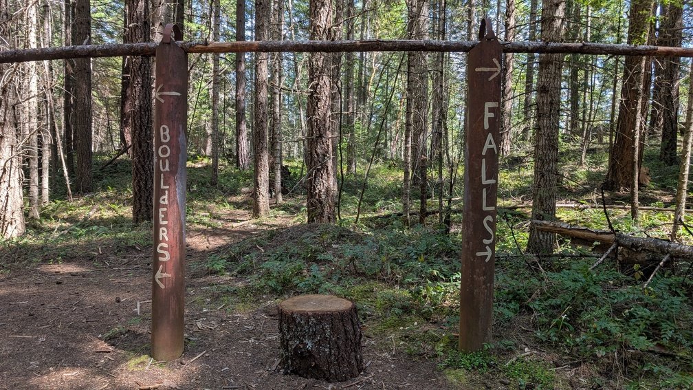
- From Highway 62, turn east on Mill Creek Road through the town of Prospect for 1.5 miles to the Mill and Barr Creek Falls Trailhead parking lot; the trail descends into shaded Douglas fir and incense cedar forest for approximately 0.5 miles to a fork — left leads to the Avenue of the Giant Boulders, right leads to the Mill Creek Falls and Barr Creek Falls viewpoints
- The viewpoints near the falls are unguarded with exposed cliff edges — exercise extreme caution, especially near slippery mist-covered rocks; dogs must be leashed; the Avenue of the Giant Boulders is an additional 0.5-mile detour from the main falls trail
- Parking:
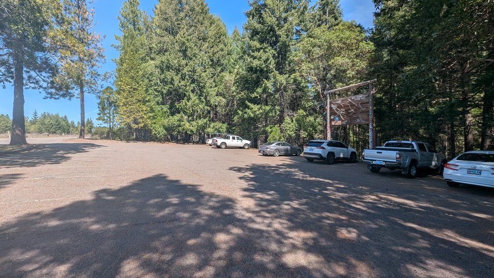
- Free parking at the Mill Creek Falls Trailhead on Mill Creek Road; picnic tables and a pit bathroom available; no fee
- Accessibility:
- Not wheelchair accessible; the trail descends steeply and viewpoints have unguarded cliff edges
Best Time to Visit
- Spring: Best flows; the full power of Mill Creek hurls dramatically over the cliff; rainbow-filled mist at the base viewpoint
- Summer: Flows moderate but consistent; a good stop on the Crater Lake Highway (Hwy 62) corridor
- Fall: Excellent conditions; good flows through fall; crisp air makes for dramatic waterfall photography
- Winter: Falls run powerfully; may partially freeze in cold snaps for dramatic photography; road access open year-round
Nearby Attractions
- Barr Creek Falls (240 ft, same trail — 0.25 miles further)
- Avenue of the Giant Boulders (same trailhead)
- Pearsony Falls (~0.25 miles upstream on Mill Creek)
- Natural Bridge (Rogue River)
- Crater Lake National Park (~35 miles northeast)
References
- Links:
- Books:
- Oregon Waterfalls by Greg Plumb
- Waterfall Lover’s Guide: Pacific Northwest
Map
Sorry, no records were found. Please adjust your search criteria and try again.
Sorry, unable to load the Maps API.