Most visitors to Central Oregon drive right past the entrance road. Here’s everything you’re missing.
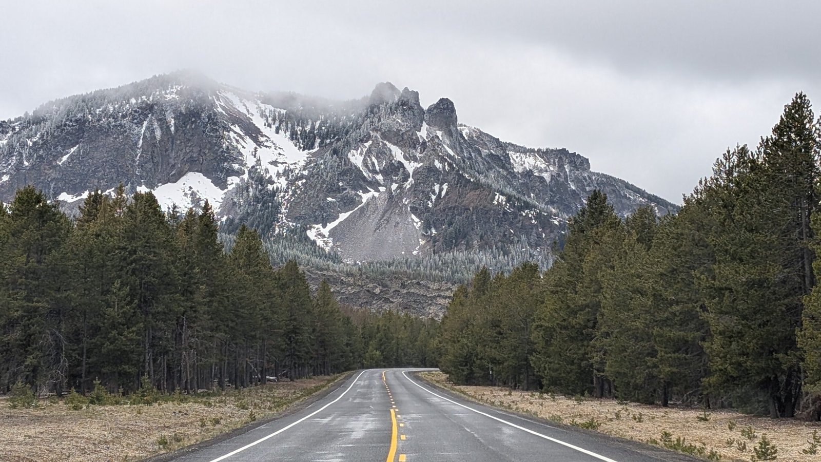
Thirty-five miles south of Bend, tucked off Highway 97 on a winding forest road, is one of the most geologically extraordinary landscapes in the United States — and one of the most undervisited destinations in Oregon. Newberry National Volcanic Monument protects the caldera and flanks of Newberry Volcano, a shield volcano so vast it covers over 1,200 square miles. Inside that caldera: two crater lakes, a field of jet-black obsidian as fresh as anything the ancient Pacific Paiute ever quarried for arrowheads, a peak nearly 8,000 feet tall, natural hot springs, and two excellent waterfalls.
A quick note before we go further: the lakes, creek, falls, and peak are all named Paulina — pronounced paw-LYE-nuh. Not like the name Paula. Not paw-LEE-nuh. The stress falls on the second syllable with a long “I” sound. The name honors Chief Paulina, a Northern Paiute war leader who fiercely resisted the displacement of his people from their homelands throughout the 1860s. His actual Paiute name was Pahninee. Say the name right and you’re already honoring the history.
This guide covers the two waterfalls that anchor the experience, what to do for a full weekend, where to camp, and — for those who want to make a longer trip of it — the remarkable collection of volcanic and outdoor attractions clustered in the surrounding Bend/Sunriver/La Pine corridor.
The Waterfalls
Paulina Creek Falls — The Headliner
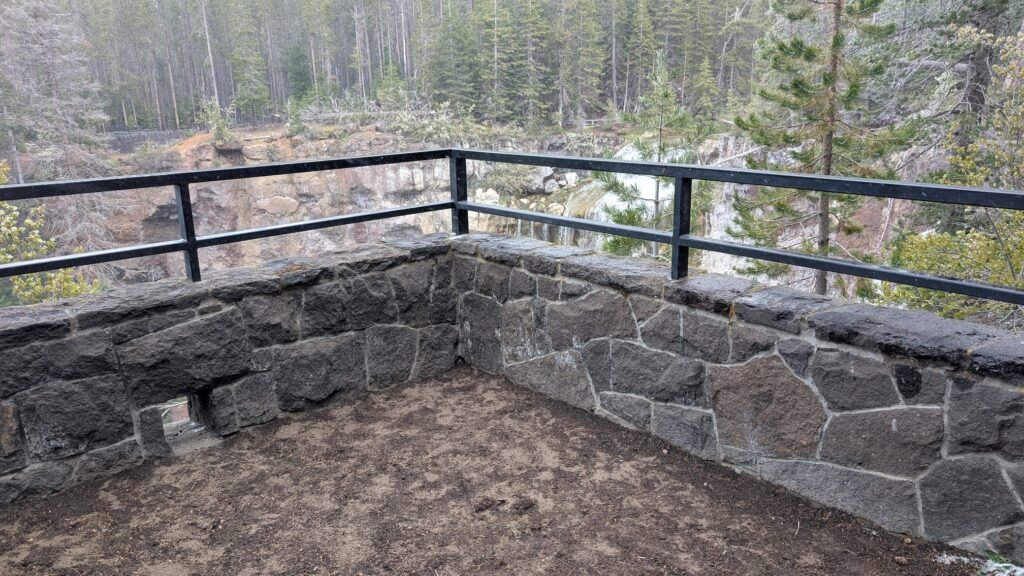
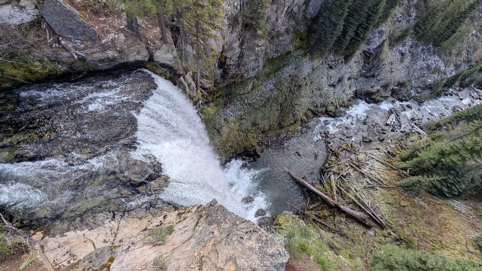
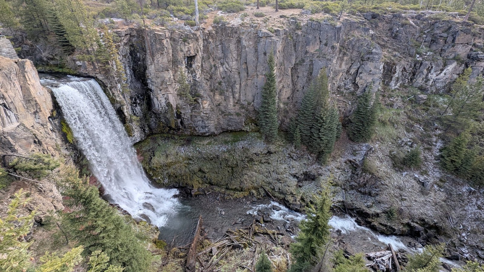
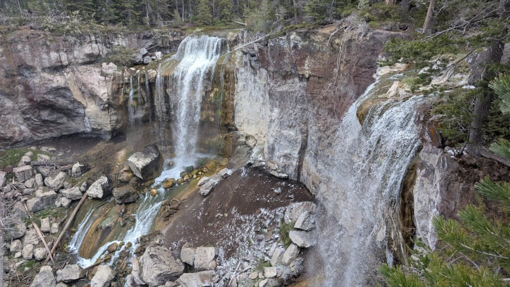
Paulina Creek Falls is an 80-foot double plunge at the very edge of Newberry Volcano’s caldera rim — where Paulina Creek, draining from the crater lake above, simply launches itself over the cliff and drops in twin columns onto the volcanic rocks below. It is one of the most dramatic roadside-accessible waterfalls in Central Oregon, and it comes with a paved trail, informational signs, a stone wall guardrail, and a parking lot that fills by 10 AM on summer weekends.
There are three ways to experience the falls:
The main overlook — a wide, paved path from the Paulina Falls Day Use Area leads to the classic view. Most visitors stop here. It’s genuinely spectacular, and suitable for anyone who can make the short walk.
The base viewpoint — a second trail descends via steep, well-maintained switchbacks through mossy ponderosa and lodgepole pine forest (0.5 miles round-trip, 114 ft elevation change). Going down is easy; the climb back up at 6,300 feet elevation is where some visitors discover their lungs have opinions. The base gives you a completely different — and more immersive — perspective of the falls. Note that the boulder field immediately at the base is closed for restoration; respect the signs.
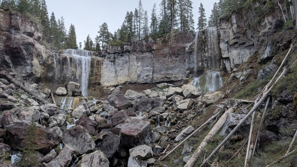
The Paulina Lake side — park near the lake and walk the Peter Skene Ogden Trail west for about a half mile to reach a viewpoint looking across the falls from the opposite side. A quieter angle that most visitors never discover.
Directions to the Day Use Area: From Bend, drive south on Highway 97 approximately 23.5 miles, then turn east on Paulina Lake Road (County Road 21). Drive 12.3 miles to the parking area on the left. Fee required ($5/day or America the Beautiful Pass). Vault toilet on site; no potable water.
McKay Falls — The Discovery
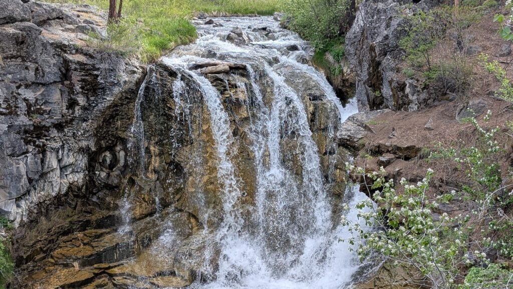
Four miles downstream from Paulina Creek Falls, where the Peter Skene Ogden Trail passes through McKay Crossing Campground, McKay Falls drops 60 feet over a volcanic ledge into a clear pool. It is everything Paulina Creek Falls is not: off the main road, quiet, accessible to virtually no one who isn’t specifically looking for it, and surrounded by the kind of ponderosa and lodgepole pine forest that makes you slow down.
A visitor-built pool dammed with stacked rocks at the base provides a popular summer wading spot, though access to it is steep. The campground itself sits above the falls in the forest — and camping here means the falls are 0.1 miles from your tent.
Access: Turn off Paulina Lake Road at the McKay Crossing Campground turnoff (marked), then drive 2.1 miles on a well-maintained dirt road to the campground. The falls are just northwest of the campground; follow the path off the campground road. Be considerate of campers — don’t cut through occupied sites.
The Natural Water Slide
Between McKay Falls and Paulina Lake, the Peter Skene Ogden Trail passes one of Central Oregon’s finest summer secrets: a natural basalt water slide on Paulina Creek, approximately 1.5 miles upstream from McKay Crossing. Smooth volcanic rock has been polished by millennia of Paulina Creek’s flow into a frictionless chute that deposits swimmers into a deep, cold pool below. It is exactly as fun as it sounds.
If you’re based at McKay Crossing Campground, this is a natural half-day hike: walk upstream 1.5 miles to the slide, spend an afternoon in the water, walk back. The full Peter Skene Ogden Trail runs 8.5 miles one-way from the lower trailhead to Paulina Lake, connecting the slide, McKay Falls, and Paulina Creek Falls in a single corridor — one of the best full-day hikes in the Newberry Monument.
The Big Obsidian Flow
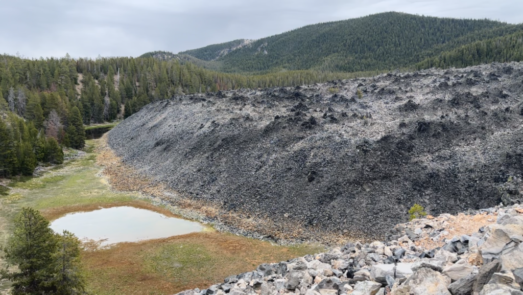
Do not drive all the way to Newberry National Volcanic Monument and skip the Big Obsidian Flow. Just don’t.
The flow was created approximately 1,300 years ago in Newberry Volcano’s most recent eruption — making it the youngest volcanic landscape in Oregon. A 0.7-mile interpretive trail crosses the surface of what is essentially a frozen black sea, with obsidian chunks ranging from pebbles to boulders. The same eruption that created this flow produced pumice that floated to the surface while the denser obsidian sank — explaining why the flow has both glassy black stone and grey pumice in adjacent areas.
The Paiute people traveled here for centuries to harvest obsidian for arrowheads, blades, and trade goods. The material is so sharp that obsidian scalpels are used in some European surgeries today; they leave a finer edge than stainless steel. Standing in the middle of the flow and knowing that people came here for thousands of years to collect this material adds a dimension to the hike that no amount of geological context quite matches.
The trail is paved but strenuous in direct sun — wear sunscreen, bring water, and go in the morning if possible.
Paulina Peak
At 7,984 feet, Paulina Peak is the highest point on the Newberry Caldera rim — and a genuinely rewarding climb with views that on a clear day stretch from Mount Rainier to Mount Shasta. The volcanic plateau, the twin crater lakes below, Cascade peaks from Three Sisters to Mount Bachelor to Broken Top, and the high desert extending endlessly to the east: it is one of Central Oregon’s finest panoramas.
The peak is accessible two ways: by scenic paved road (drive most of the way) or by a 6.1-mile out-and-back trail gaining 1,600 feet. The trail is a serious hike at elevation and not a casual stroll — but it rewards the effort in proportion.
The Lakes: Paulina and East
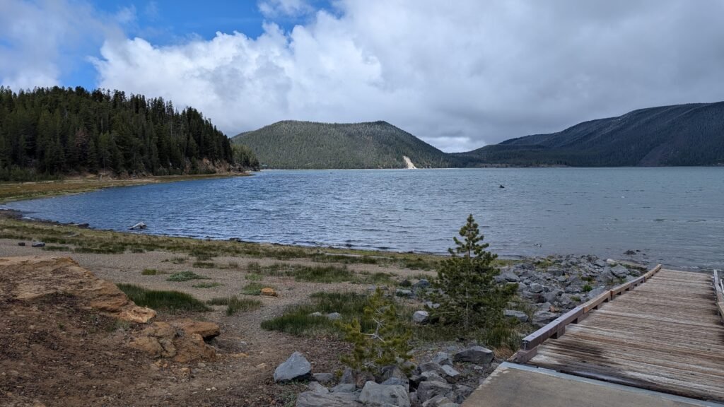
Paulina Lake is the larger of the two crater lakes at 1,531 acres and 250 feet deep, drained by Paulina Creek through the caldera’s west wall. The water is cold, clear, and remarkable for both fishing (large brown trout and kokanee salmon) and non-motorized recreation. Paddleboarding and kayaking here is genuinely otherworldly — floating on a volcanic crater lake at 6,300 feet elevation, surrounded by the caldera rim, with the obsidian flow visible across the water. Boat rentals are available at Paulina Lake Lodge on the west shore. Thermal vents along the northeast shoreline warm sections of the lake — the source of the hot springs at Paulina Hot Springs, a few miles east along the shoreline trail.
East Lake sits about 40 feet higher and one mile east of Paulina Lake inside the same caldera, with visible geothermal hot springs emerging from the lakebed and shore. The springs are cool enough to linger in along the southeast edge — a natural, undeveloped soak with no infrastructure and no crowds. East Lake also produces excellent fishing, particularly for rainbow and brown trout and Atlantic salmon. Both motorized and non-motorized boats are permitted on both lakes with a 10 mph speed limit.
Where to Camp
The Newberry Monument and surrounding Deschutes National Forest offer a range of camping options from free and primitive to developed and reservable. Here is a practical breakdown:
McKay Crossing Campground — The best base camp for waterfall visitors. Free, primitive, 10 sites, first-come first-served. Open Memorial Day to September 30. Fire rings and vault toilet; no potable water. Situated above McKay Falls in an old-growth forest setting — wake up and you’re already at the waterfall.
Paulina Lake Campground — The largest and most developed campground in the monument, near Paulina Lake Lodge on the west shore. Multiple loops with varied site types; reserve through Recreation.gov for summer weekends.
Little Crater Campground — On the south shore of Paulina Lake near the Little Crater volcanic feature and viewpoint. Popular with anglers and paddlers; good access to the lakeshore. Reserve on Recreation.gov.
East Lake Campground — On the west shore of East Lake, giving easy access to the lake and the hot springs. More remote character than the Paulina Lake campgrounds.
Cinder Hill Campground — On the northeast shore of East Lake, the largest of the East Lake campgrounds and the most popular for RVs and families. Electric hookups available in some sites. Closest to the East Lake Hot Springs.
Prairie Campground — A quieter option along Paulina Lake Road before reaching the caldera, with a more forested feel. Good for those who want a Newberry base without the monument’s crowds.
Hot Springs Campground — A smaller campground on the Paulina Lake lakeshore near the geothermal hot springs area.
Tip: For summer weekends, book Paulina Lake, East Lake, Cinder Hill, and Little Crater campgrounds well in advance on Recreation.gov. McKay Crossing and Prairie are first-come first-served and your best bet without reservations.
Making the Most of a Longer Trip: The Bend–Sunriver–La Pine Corridor
Newberry National Volcanic Monument sits at the center of one of Oregon’s most activity-dense recreation corridors. If you have more than a weekend — or if you’re building a full Central Oregon itinerary around the monument — here’s what’s worth knowing about the surrounding area.
Benham Falls and the Deschutes River Trail
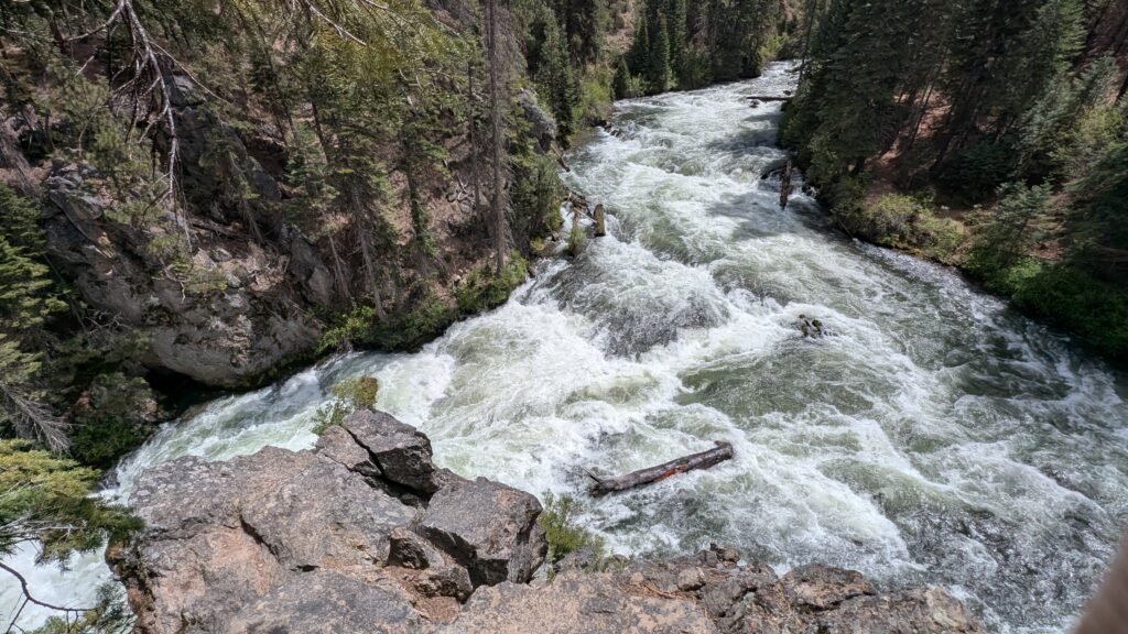
Benham Falls on the Deschutes River is one of Oregon’s best examples of a waterfall born directly from volcanic geology. Ancient lava flows dammed and redirected the Deschutes, creating the stepped cascade and rapids visible today. The Deschutes River Trail connects Benham Falls to Dillon Falls and Lava Island Falls in a flat, paved riverside corridor through stunning ponderosa pine forest — one of Bend’s most beloved recreational routes and an excellent complement to a Newberry Monument visit. The trailhead is approximately 11 miles west of Bend, off Highway 97 at the Lava Lands Visitor Center road.
Lava Lands Visitor Center and Lava Butte
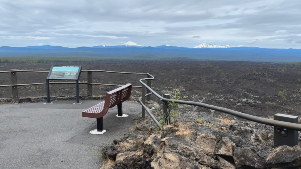
The Lava Lands Visitor Center on Highway 97 (approximately 11 miles south of Bend) is the best single stop for understanding the volcanic landscape that defines this entire region. The exhibits explain the geology of the High Cascades in accessible, visual terms — essential context for anyone who wants to understand why Newberry Volcano, Paulina Creek Falls, the Big Obsidian Flow, and Benham Falls all exist. Adjacent to the visitor center, Lava Butte is a 500-foot cinder cone with a 1-mile paved spiral trail to the summit fire lookout. The views from the top — the vast black lava flow spreading to the horizon, the Cascade peaks arrayed to the north and west, Newberry Volcano’s dome to the south — are among the finest in Central Oregon for the minimal effort required.
Don’t miss Lava River Cave across the highway from the visitor center: a one-mile lava tube you can walk through with a lantern, keeping a consistent 42°F year-round. Bring a warm layer regardless of the outside temperature and a headlamp.
Sunriver: Bikes, Floats, and a Water Park
Sunriver is the resort community 15 miles north of La Pine with over 40 miles of paved bike paths connecting every corner of the development — rental bikes available everywhere. Floating the Deschutes River from Sunriver (typically from Benham Falls area to Meadow Picnic Area) is a classic Central Oregon summer afternoon. The SHARC aquatic center (Sunriver Homeowners Aquatic & Recreation Center) has water slides, pools, and a lazy river open to non-resort guests in season. The Sunriver Village has a good concentration of restaurants, coffee shops, and a grocery store that makes stocking camp food straightforward. The Sunriver Nature Center and Observatory offers some of the darkest skies accessible from a populated area in Oregon.
La Pine State Park
La Pine State Park preserves a remarkable stand of old-growth ponderosa pine — some of the oldest individual trees in Oregon, with the park’s oldest exceeding 500 years. The park sits along the Little Deschutes River with camping, hiking, and some of the most peaceful forest walking in the high desert transition zone. For those who’ve spent several days in the volcanic landscape of Newberry Monument and want something quieter and more intimate, La Pine State Park is the place. It also connects via a trail corridor to the Deschutes National Forest lands north toward Sunriver.
Other Nearby Highlights Worth Your Time
High Desert Museum (south of Bend on Hwy 97) — One of the best natural and cultural history museums in the Pacific Northwest, with live wildlife exhibits, Indigenous history, and natural history of the Great Basin and High Desert. A rainy-day anchor or a must-visit addition to any Central Oregon trip.
Smith Rock State Park (north of Redmond, ~35 miles north of Bend) — World-class rock climbing and one of Oregon’s most photographed landscapes. Misery Ridge Loop is the classic half-day hike with views of the Crooked River canyon, the Cascade peaks, and the basalt spires.
Cascade Lakes Scenic Byway — From Bend heading west toward Mount Bachelor and the Cascade Lakes: Sparks Lake, Hosmer Lake, Elk Lake, Lava Lake, Davis Lake. A spectacular high-elevation volcanic lake country drive with kayaking, canoeing, fishing, and camping at every stop.
Fort Rock State Monument (~60 miles southeast of La Pine) — A dramatic volcanic tuff ring rising from the high desert, visible from miles away. One of Oregon’s strangest and most beautiful geological features, with early human occupation evidence dating back over 9,000 years (ancient woven sagebrush sandals found here are among the oldest footwear in North America).
Practical Planning Notes
Getting here from Bend: Highway 97 south ~23.5 miles to Paulina Lake Road (County Road 21), then 12.3 miles east to the monument entrance. Approximately 35 minutes from Bend.
Getting here from Klamath Falls: Highway 97 north approximately 80 miles; approximately 1.5 hours. The monument is an excellent stop or base camp between Klamath Falls and Bend.
Fees: $5/vehicle day-use fee or America the Beautiful/Northwest Forest Pass at the Paulina Falls Day Use Area and most monument trailheads. McKay Crossing Campground is currently free.
Road season: Paulina Lake Road typically opens late May or early June and closes with the first significant snowfall, usually October. Check USFS Deschutes alerts before visiting.
No potable water at McKay Crossing Campground or the Paulina Falls Day Use Area. Bring or filter water. Paulina Lake Lodge has limited food service and restrooms in season.
Cell service is limited throughout the monument. Download maps and AllTrails routes offline before leaving.
The Short Version
If you have one day, do this: drive Paulina Lake Road to the Paulina Falls Day Use Area, walk the overlook to Paulina Creek Falls, drive back to the McKay Crossing turnoff for McKay Falls, then drive back up to the caldera for the Big Obsidian Flow and a paddle on Paulina Lake. You’ll be back in Bend by dinner.
If you have a weekend, add the Paulina Peak climb, the natural water slide hike from McKay Crossing, and a morning on East Lake. Camp at McKay Crossing or Little Crater. Swing through Lava Lands and Benham Falls on the way home.
If you have more time than that, Central Oregon will fill it.
Explore our complete waterfall profiles for Paulina Creek Falls and McKay Falls in the Best Oregon Waterfalls directory.