
Profile
Overview
- Location: Coos County, Oregon Coast Range (East Fork Coquille River, near Sitkum — on the historic Coos Bay Wagon Road)
- Waterfall Type: Cascade
- Height: ~20 feet (6 m)
- Trail Distance: Roadside viewpoint; optional informal scramble of approximately 500 feet to the river base
- Difficulty: Easy view from roadside; medium or difficult scramble.
- Best Time to Visit: Spring through fall (road not recommended in winter)
- Combine: Lower East Fork Falls is a much better view, less than 0.5 miles west of Middle East Fork Falls and worth the drive.
History & Background
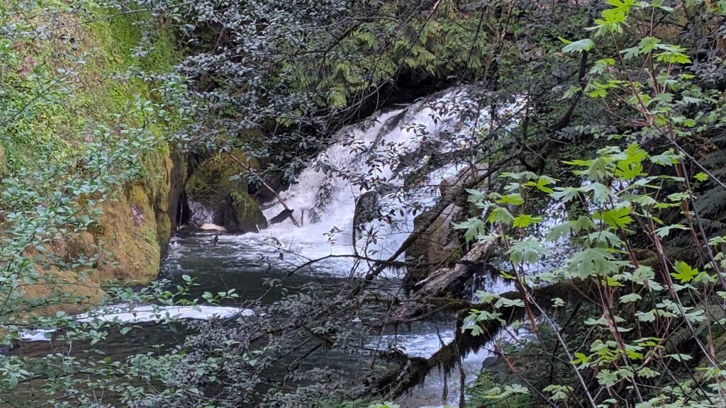
Middle East Fork Falls is a small cascade on the East Fork Coquille River, the second of four named waterfalls encountered on the historic Coos Bay Wagon Road between Sitkum and the Coos-Douglas county line. It sits at a bend in the road roughly a third of a mile east of Lower East Fork Falls, and is best appreciated as part of a corridor stop rather than a destination in its own right.
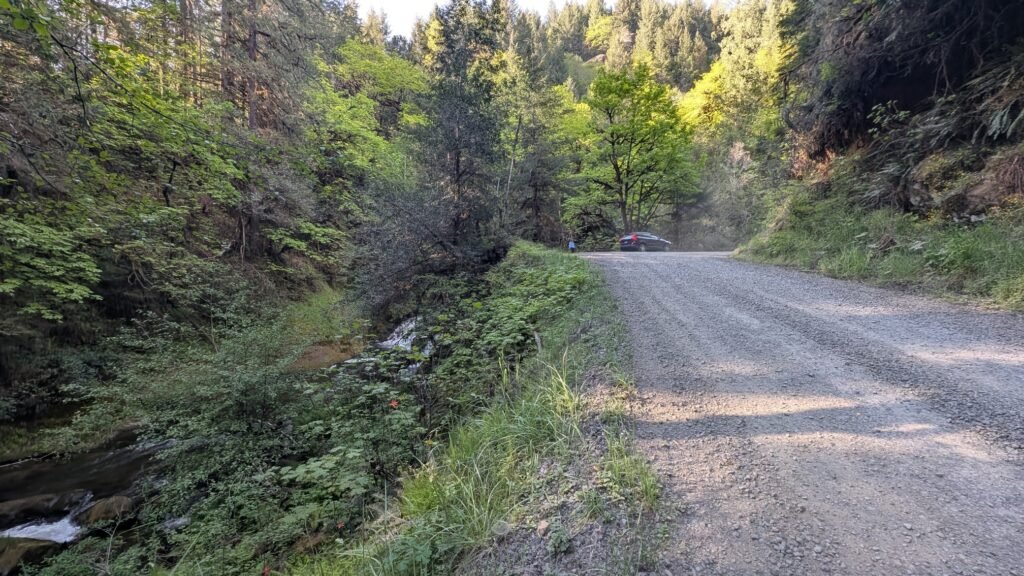
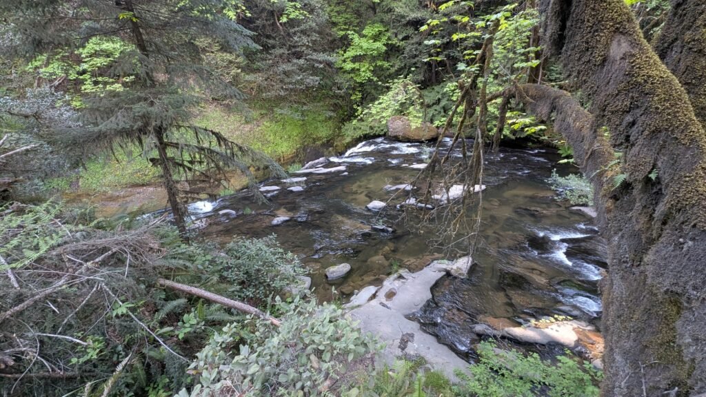
The waterfall is partially screened by the dense alder and Douglas fir canopy along the river — from the roadside pullout the falls is visible but the view is framed through trees, limiting photography opportunities from the road. Those willing to pick their way carefully down the short steep bank to the river level will find a considerably better vantage from the base, where the full cascade is visible without obstruction. The Oregon Waterfalls blog, which visited this corridor in 2021, noted the same: “Middle East Fork Falls does offer a bit of adventure. We found a way down to the river at the top of the falls, and from there made it down to the base of the falls. The photo below is much better than anything you can capture from the road.”
The East Fork Coquille River that feeds these falls has been a working waterway for well over a century. The Coos Bay Wagon Road, which runs alongside it, was one of four federally-contracted pioneer roads built in Oregon in the early 1870s and remains the only one still in use today — connecting the interior valleys of Douglas County to the coast through a route that once carried freight, settlers, and early timber operations through this corner of the southern Coast Range.
For those simply passing through on the Wagon Road, Middle East Fork Falls is a pleasant quick stop. For those making the drive specifically to see waterfalls, it works best as a companion to Lower East Fork Falls rather than a standalone destination.
Geology
Middle East Fork Falls cascades over a ledge on the East Fork Coquille River at approximately 400 feet elevation in the Coos County Coast Range. The southern Oregon Coast Range in this area transitions toward the Klamath Mountains geological province, with older metamorphic rocks and complex volcanic formations underlying a forest of Douglas fir, red alder, and bigleaf maple. The dense riparian vegetation along the East Fork — the same growth that partially screens the falls from the road — reflects the abundant annual rainfall of the southern Coast Range and the river’s role as a productive salmon and steelhead stream.
Directions & Access
Nearest City: Coquille, OR (~8 miles west via Coos Bay Wagon Road)
Getting There: Follow the same approach as Lower East Fork Falls. From Coquille, take Fairview Road east to Lone Pine Road, then left on Coos Bay Wagon Road (Sitkum County Line Road) through Sitkum. Lower East Fork Falls appears after 4.6 miles; Middle East Fork Falls is another 0.35 miles east at a bend in the road. See the Lower East Fork Falls page for complete directions.
Viewpoint: The falls is visible from a roadside pullout at the bend in the road, but partially screened by trees. For a better view and photo opportunity, pick your way carefully down the short bank to the river level — the scramble is approximately 250 feet each way and informal but manageable.
Road conditions: Several sections of the Coos Bay Wagon Road are gravel with a reputation for potholes. Passable for standard passenger cars in dry conditions; not recommended in winter.
Parking: Roadside pullout at the bend in the road; no fee; no facilities.
Accessibility: Roadside viewpoint accessible for most visitors; river-level scramble is informal and not suitable for those with limited mobility.
Best Time to Visit
Spring: Best flows; East Fork runs strong from coastal rains; roadside view most active.
Summer: Reduced flow; the corridor is pleasant to drive; the river-level scramble is easiest in drier conditions.
Fall: Flows return with October rains; fall color from riverside alder and maple; a nice back-road drive.
Winter: Road not recommended — gravel sections can be difficult in wet conditions. Avoid.
Nearby Attractions
- Lower East Fork Falls (0.35 miles west on the same road — start here)
- Little East Fork Falls (~800 feet east of Lower East Fork Falls — an informal ~10-foot cascade)
- Upper East Fork Falls (~0.6 miles east — small cascade, rustic campsite)
- Golden and Silver Falls State Natural Area (~30 miles northwest)
- Coquille, Oregon
- Bandon (~20 miles southwest)
References
-
Links:
- Coos Bay Wagon Road — Wikipedia
- Coos Bay Wagon Road Falls — oregonwaterfalls.wordpress.com
- Northwest Waterfall Survey — Middle East Fork Falls
- Oregon’s Adventure Coast — Coos Bay Area
Books:
- Waterfall Lover’s Guide: Pacific Northwest by Greg Plumb
Map
Sorry, no records were found. Please adjust your search criteria and try again.
Sorry, unable to load the Maps API.