
Profile
Overview
-
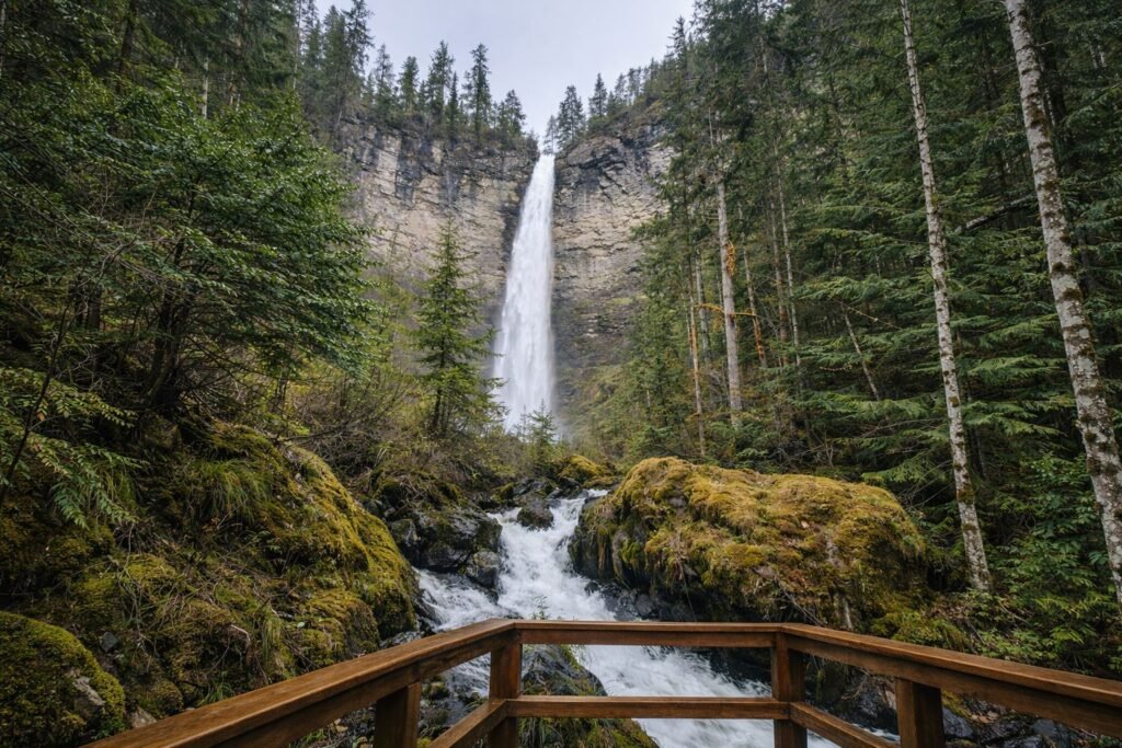
Location: Southern Oregon, Umpqua National Forest
-
Waterfall Type: Plunge
-
Height: ~293 feet
-
Trail Distance: ~0.6 miles round-trip
-
Difficulty: Easy
-
Best Time to Visit: Spring through early summer
History & Background
Watson Falls is one of the tallest waterfalls in Southern Oregon and a popular stop along the North Umpqua River corridor. Named after early settlers in the region, the waterfall has long been appreciated for its dramatic drop and forested setting. Its relatively short trail and roadside access make it a favorite destination for travelers exploring the Umpqua National Forest.
Geology
Watson Falls plunges over volcanic rock formed by ancient lava flows in the Cascade Range. The narrow canyon and steep cliffs amplify the height and power of the waterfall, especially during peak runoff. The surrounding area features dense forest and classic Cascade geology shaped by volcanic activity and erosion.
Directions & Access
-
Nearest City: Prospect, OR
-
Trail Information:
-
Short out-and-back trail through forest
-
Mild elevation gain with well-maintained path
-
-
Parking:
-
Dedicated Watson Falls Trailhead parking lot
-
Located along North Umpqua Highway (OR-138)
-
-
Accessibility:
-
Not wheelchair accessible
-
Uneven terrain near viewpoints
-
Best Time to Visit
-
Spring: Peak flow from snowmelt and rain; most impressive water volume
-
Summer: Reliable flow and good trail conditions; popular with visitors
-
Fall: Lower flow with fewer crowds and cooler temperatures
-
Winter: Snow and ice may limit access; conditions can be hazardous
Nearby Attractions
-
Toketee Falls
-
Clearwater Falls
-
Umpqua Hot Springs
-
North Umpqua River Scenic Byway
References
-
Links:
-
Books:
-
Oregon Waterfalls by Greg Plumb
-
Waterfall Lover’s Guide: Pacific Northwest
-
Map
Sorry, no records were found. Please adjust your search criteria and try again.
Sorry, unable to load the Maps API.