
Profile
Overview
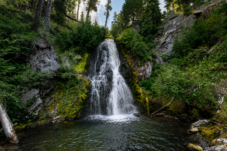
- Location: Hood River County, Columbia River Gorge / Mount Hood National Forest (East Fork Hood River near ski area)
- Waterfall Type: Horsetail
- Height: ~78 feet (24 m)
- Trail Distance: Short walk from roadside; approximately 0.1 miles
- Difficulty: Easy
- Best Time to Visit: Year-round
History & Background
Sahale Falls, not to be confused with the much larger Sahalie falls on the McKenzie River, is a graceful 78-foot horsetail on the East Fork of the Hood River, visible directly from the Historic Columbia River Highway near Rhododendron on the west slope of Mount Hood. The falls are one of the most easily accessible on the Mount Hood corridor — a roadside stop that rewards even the most rushed traveler with a view of a beautiful cascade. The Zigzag River takes its name from the zigzag character of the canyon’s course, which in turn gave its name to the nearby community of Zigzag and the Forest Service’s Zigzag Ranger District. The Sandy River, into which the Zigzag flows, was named ‘Quicksand River’ by Lewis and Clark in 1805 due to its glacial-silt color, later simplified to Sandy.
Geology
Sahale Falls drops 78 feet over a basaltic ledge on the Zigzag River at approximately 1,500 feet elevation on the southwestern slope of Mount Hood. The Zigzag carries glacial meltwater from Mount Hood’s Sandy Glacier, maintaining strong spring flows that diminish in summer as glacial input decreases. The surrounding forest transitions from lower-elevation Douglas fir and western hemlock to the mixed subalpine forest typical of the Mount Hood mid-elevation zone. The basalt ledge creating the falls is part of the High Cascades volcanic terrain that dominates Mount Hood’s slopes.
Directions & Access
- Nearest City: Rhododendron, OR (~3 miles west); Government Camp, OR (~10 miles east)
- Trail Information:
- Roadside pullout on Highway 26 (or a connecting forest road) provides immediate access to the falls viewpoint; the falls are visible from or very near the road
- Sahale Falls is an easy addition to any Mount Hood day trip and pairs well with visits to Little Zigzag Falls, Ramona Falls, or Timberline Lodge on the same corridor
- Parking:
- Roadside pullout near the falls; no fee
- Accessibility:
- Short, essentially flat access from the roadside; generally accessible for most visitors
Best Time to Visit
- Spring: Best flows from snowmelt; the Zigzag carries its highest volume spring through early summer
- Summer: Lower flows as glacial contribution decreases; still a pretty roadside cascade; warm and busy on Hwy 26
- Fall: Flows diminish further; a pleasant quick stop on Mount Hood drives
- Winter: Open year-round; winter snowfall can create dramatic ice formations at the falls
Nearby Attractions
- Little Zigzag Falls (~3 miles east)
- Ramona Falls (~6 miles east via forest road)
- Timberline Lodge (~12 miles east)
- Mirror Lake Trail
- Zigzag Ranger Station
References
- Links:
- Books:
- Oregon Waterfalls by Greg Plumb
- Waterfall Lover’s Guide: Pacific Northwest
Map
Sorry, no records were found. Please adjust your search criteria and try again.
Sorry, unable to load the Maps API.