Profile
Overview
-
Location: Central Oregon, Willamette National Forest (McKenzie River)
-
Waterfall Type: Plunge
-
Height: ~100 feet
-
Trail Distance: ~0.3 miles round-trip (paved viewpoints)
-
Difficulty: Easy
-
Best Time to Visit: Spring through early summer
History & Background
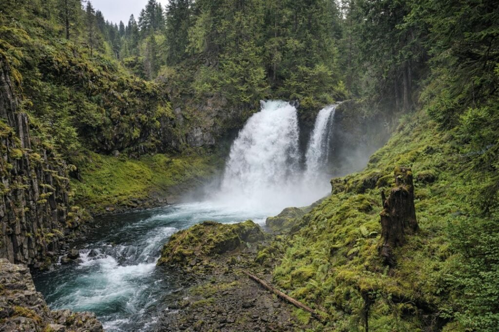
Sahalie Falls is one of the most powerful and recognizable waterfalls on the McKenzie River and a long-standing roadside attraction in the central Cascades. The name “Sahalie” comes from Chinook jargon meaning “high” or “above,” reflecting the waterfall’s commanding presence. Its accessibility and volume have made it a favorite stop for travelers along the McKenzie Highway for decades.
Geology
Sahalie Falls marks a dramatic drop in the McKenzie River as it flows over hardened volcanic rock formed by ancient lava flows. The river narrows sharply at the brink, forcing a massive volume of water over the ledge and into a churning pool below. The surrounding landscape reflects classic Cascade volcanism, with basalt formations, dense forest, and a steep river canyon.
Directions & Access
-
Nearest City: McKenzie Bridge, OR
-
Trail Information:
-
Short paved paths to multiple viewpoints
-
Stairs connect upper and lower viewing areas
-
-
Parking:
-
Sahalie Falls Day Use Area parking lot
-
Northwest Forest Pass required
-
-
Accessibility:
-
Upper viewpoints are wheelchair accessible
-
Lower viewpoints require stairs
-
Best Time to Visit
-
Spring: Peak flow from snowmelt; thunderous water volume
-
Summer: Strong, consistent flow; very popular with visitors
-
Fall: Slightly reduced flow with fewer crowds and cooler weather
-
Winter: Snowy access common; viewpoints may be icy
Nearby Attractions
-
Koosah Falls
-
Proxy Falls
-
McKenzie River Trail
-
Clear Lake
References
-
Links:
-
Books:
-
Oregon Waterfalls by Greg Plumb
-
Waterfall Lover’s Guide: Pacific Northwest
-
Map
Sorry, no records were found. Please adjust your search criteria and try again.
Sorry, unable to load the Maps API.