
Profile
Overview
-
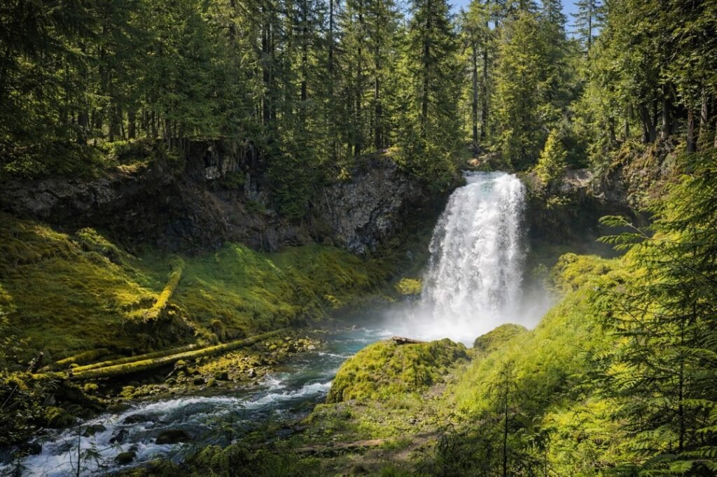
Location: Central Oregon, Willamette National Forest (McKenzie River)
-
Waterfall Type: Plunge
-
Height: ~70 feet
-
Trail Distance: ~0.5 miles round-trip (paved viewpoints)
-
Difficulty: Easy
-
Best Time to Visit: Spring through early summer
History & Background
Koosah Falls is one of the most well-known waterfalls along the McKenzie River and is often visited together with nearby Sahalie Falls. The name “Koosah” comes from Chinook jargon meaning “sky” or “heaven,” reflecting the waterfall’s dramatic appearance. Its roadside access and short, developed trails have made it a popular stop for travelers along the McKenzie Highway for decades.
Geology
Koosah Falls marks a sudden drop in the McKenzie River as it flows over resistant volcanic rock formed by ancient lava flows in the central Cascade Range. The river narrows at the brink before plunging into a churning pool below, creating a powerful and visually striking waterfall. The surrounding canyon walls showcase classic Cascade volcanism, with basalt formations shaped by erosion over time.
Directions & Access
-
Nearest City: McKenzie Bridge, OR
-
Trail Information:
-
Short paved trails connect multiple viewpoints
-
Trail links Koosah Falls with Sahalie Falls via a riverside path
-
-
Parking:
-
Koosah Falls Day Use Area parking lot
-
Northwest Forest Pass required
-
-
Accessibility:
-
Paved viewpoints are wheelchair accessible
-
Some lower viewpoints require stairs
-
Best Time to Visit
-
Spring: Peak flow from snowmelt; loud, powerful water volume
-
Summer: Strong and steady flow; busiest season
-
Fall: Slightly reduced flow with cooler temperatures and fewer crowds
-
Winter: Snow and ice common; viewpoints may be slippery
Nearby Attractions
-
Sahalie Falls
-
Proxy Falls
-
Clear Lake
-
McKenzie River Trail
References
-
Links:
-
Books:
-
Oregon Waterfalls by Greg Plumb
-
Waterfall Lover’s Guide: Pacific Northwest
-
Map
Sorry, no records were found. Please adjust your search criteria and try again.
Sorry, unable to load the Maps API.