
Profile
Overview
-
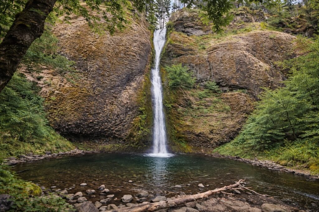
Location: Columbia River Gorge, Oregon
-
Waterfall Type: Tiered / Plunge
-
Height: ~118 feet (combined tiers)
-
Trail Distance: ~0.6 miles round-trip
-
Difficulty: Easy
-
Best Time to Visit: Spring through early summer
History & Background
Bridal Veil Falls is one of the earliest developed recreational waterfalls in the Columbia River Gorge. The surrounding area was once home to the Bridal Veil Lumbering Company, which operated a mill and company town in the late 1800s and early 1900s. Today, the site is preserved as Bridal Veil Falls State Scenic Viewpoint, offering visitors easy access to the lower falls and peaceful picnic areas beneath towering forest canopy.
Geology
Bridal Veil Falls cascades over layered Columbia River Basalt, splitting into multiple streams as it descends. The waterfall’s wide, delicate appearance—especially during periods of moderate flow—gives it the veil-like look that inspired its name. The surrounding canyon walls display classic Gorge basalt formations shaped by volcanic activity and erosion.
Directions & Access
-
Nearest City: Bridal Veil, OR
-
Trail Information:
-
Short, well-maintained trail through forest
-
Leads to viewpoints of the lower falls
-
-
Parking:
-
Bridal Veil Falls State Scenic Viewpoint parking area
-
Picnic tables and restrooms available
-
-
Accessibility:
-
Partial accessibility to picnic and lower viewing areas
-
Trails to viewpoints include natural surfaces
-
Best Time to Visit
-
Spring: Peak flow from rain and snowmelt; most scenic conditions
-
Summer: Reduced flow but lush surroundings and easy access
-
Fall: Lower flow with autumn color and fewer visitors
-
Winter: Variable flow; trails may be muddy or icy
Nearby Attractions
-
Latourell Falls
-
Wahkeena Falls
-
Multnomah Falls
-
Historic Columbia River Highway
References
-
Links:
-
Books:
-
Oregon Waterfalls by Greg Plumb
-
Waterfall Lover’s Guide: Pacific Northwest
-
Map
Sorry, no records were found. Please adjust your search criteria and try again.
Sorry, unable to load the Maps API.