
Profile
Overview
-
Location: Southern Oregon, Umpqua National Forest
-
Waterfall Type: Plunge
-
Height: ~113 feet
-
Trail Distance: ~0.8 miles round-trip
-
Difficulty: Easy to moderate
-
Best Time to Visit: Spring through early summer
History & Background
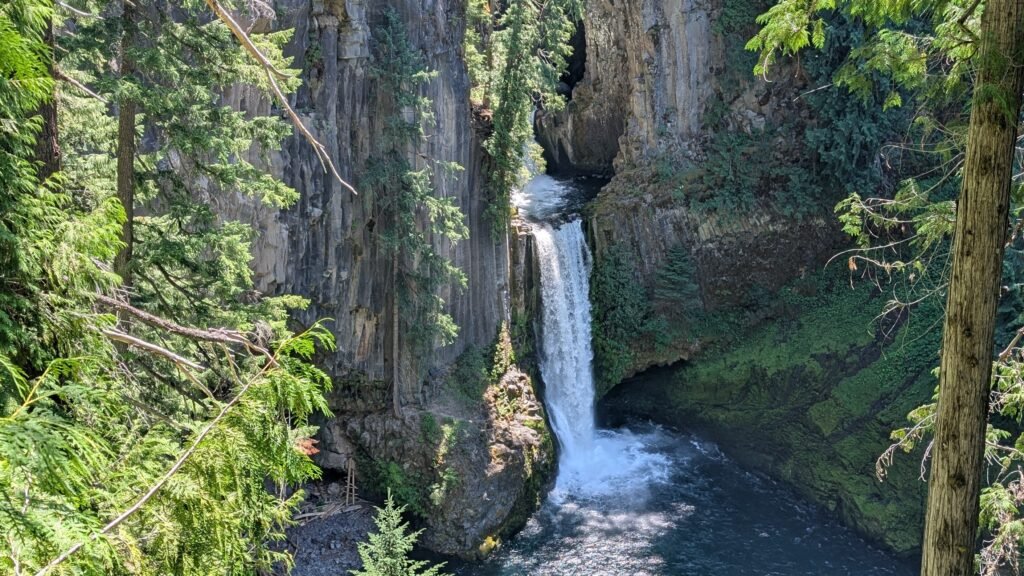
Toketee Falls is one of Southern Oregon’s most recognizable waterfalls, famous for its dramatic plunge between symmetrical columnar basalt walls. The name “Toketee” comes from a Chinook jargon word meaning “graceful” or “pretty,” a fitting description for the waterfall’s distinctive form. The site has long been a popular stop along the North Umpqua River corridor and remains a favorite for both casual visitors and photographers.
Geology
Toketee Falls flows over striking columnar basalt formed by ancient lava flows in the Cascade Range. The waterfall plunges between two vertical rock faces into a deep pool below, creating a visually unique and highly symmetrical scene. The surrounding canyon showcases classic volcanic geology common to the Umpqua region.
Directions & Access
-
Nearest City: Glide, OR
-
Trail Information:
-
Short out-and-back trail through forest
-
Includes stairs and uneven terrain near the viewpoint
-
-
Parking:
-
Dedicated Toketee Falls Trailhead parking lot
-
Located along North Umpqua Highway (OR-138)
-
-
Accessibility:
-
Not wheelchair accessible
-
Railings present at the main viewpoint
-
Best Time to Visit
-
Spring: Peak flow from snowmelt; most dramatic water volume
-
Summer: Reliable flow and best trail conditions; busiest season
-
Fall: Reduced flow but fewer crowds and crisp weather
-
Winter: Access possible, but snow and ice may impact trail safety
Nearby Attractions
-
Umpqua Hot Springs
-
Watson Falls
-
Clearwater Falls
-
North Umpqua River Scenic Byway
References
-
Links:
-
Books:
-
Oregon Waterfalls by Greg Plumb
-
Waterfall Lover’s Guide: Pacific Northwest
-
Map
Sorry, no records were found. Please adjust your search criteria and try again.
Sorry, unable to load the Maps API.