
Profile
Overview
- Location: South Silver Creek, Silver Falls State Park, Marion County, about 25 miles east of Salem
- Waterfall Type: Plunge
- Height: 177 feet
- Elevation: About 1,200 feet
- Trail Distance: Paved rim viewpoint a short walk from the parking lot. About 0.4 miles to the base and behind the falls; 2.75 miles round trip if you continue to Lower South Falls and loop back on the Maple Ridge Trail.
- Difficulty: Easy to the rim viewpoint; easy to moderate on the switchbacks down to the base
- Best Time to Visit: Spring for peak flow; summer and fall for dry trails. Watch for ice in winter and early spring.
- Fee: Oregon State Parks day-use parking permit required
- Also see: Winter Hiking at Silver Falls: our January 2026 Trail of Ten Falls update
History & Background
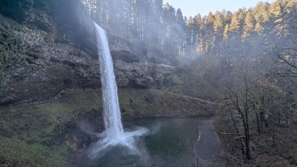
South Falls is the centerpiece of Silver Falls State Park, Oregon’s largest state park at more than 9,000 acres. The falls drop 177 feet off a basalt ledge into a wide green pool, and a trail runs right behind the water through a huge cavern in the cliff. It’s the tallest single drop on the Trail of Ten Falls and the one most visitors come to see.
Wait, Where’s Silver Falls?
Here’s the irony: Silver Falls State Park doesn’t have a waterfall called Silver Falls. None of the ten falls on the Trail of Ten Falls goes by that name. The park takes its name from Silver Creek, whose north and south forks run through the canyon, and from Silver Falls City, the old logging town that once stood above South Falls. South Falls is the closest thing the park has to a namesake falls.
If you’re looking for a waterfall actually named Silver Falls, it’s about 200 miles away by road, on the southern Oregon Coast. Silver Falls is in Golden and Silver Falls State Natural Area, east of Coos Bay, where it shares a park with its neighbor, Golden Falls. People mix the two parks up all the time, so double-check which one your map app is sending you to.
The land was home to Kalapuyan peoples, who were later removed by treaty to the Grand Ronde Reservation. In 1888, settlers founded Silver Falls City, a small logging town that sat right on top of South Falls. Logging, farming and two large 19th-century fires stripped much of the watershed.
By the 1920s South Falls had become a roadside attraction, and not a gentle one. The owner of the land around the falls charged admission to watch him push junk cars off the 177-foot cliff. In 1928, “Daredevil Al” Faussett, a former logger who made his name riding over Northwest waterfalls, went over South Falls in a boat. He was seriously injured, and his partner reportedly skipped town with the $2,500 they had collected.
Silverton photographer June Drake had a different idea. In 1931 he asked the Salem Chamber of Commerce to buy the land around the falls and give it to the state, and he began buying parcels himself. Silver Falls was dedicated as a state park in July 1933, developed under Samuel H. Boardman, Oregon’s first state parks superintendent. (Drake Falls, farther along the Canyon Trail, is named for him.)
In 1935 the federal government made the area a Recreational Demonstration Area, one of only two on the West Coast. The Civilian Conservation Corps camped here until 1942, replanting the logged hillsides and building the trails, bridges and rustic stone structures you still use today. Works Progress Administration crews built the South Falls Lodge in the late 1930s, with myrtlewood furniture made by the Federal Arts Project. The land went to the State of Oregon in 1947, and the park’s historic structures are now listed on the National Register of Historic Places.
Geology
About 25 million years ago, this area was near the Pacific shoreline, and layers of sandstone built up on the sea floor. Starting around 15 million years ago, enormous flood basalt flows of the Columbia River Basalt Group poured west across Oregon and buried that sandstone under thick sheets of hard lava.
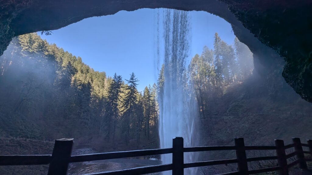
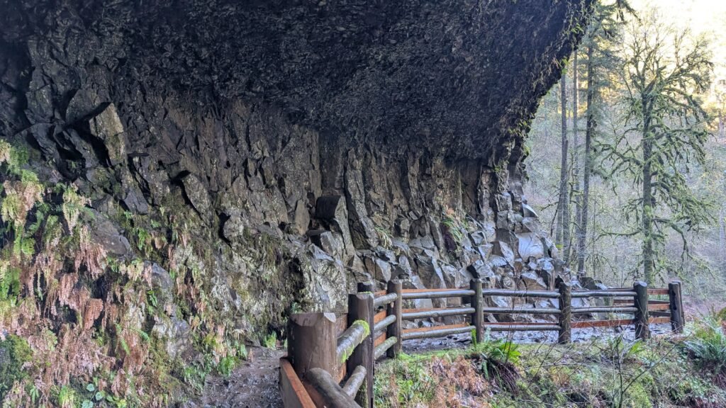
South Silver Creek later cut its canyon down through both layers, and that’s what created the walk-behind cavern. The basalt on top resists erosion, but the soft sandstone beneath it washes away much faster. Over time the creek and its spray hollowed out the sandstone under the lip of the falls, leaving a deep overhang of basalt with room for a trail behind the water. The same process formed the caverns behind North Falls, Middle North Falls and Lower South Falls.
Look up at the cavern ceilings in the park and you may see round holes called tree casts. When lava flowed around standing trees, it hardened around the trunks; the wood later burned or rotted away, leaving tube-shaped molds. Adam Sawyer’s guide points out the best examples behind North Falls.
Directions & Access
- Nearest City: Silverton, about 15 miles north on OR-214. Salem is about 25 miles west.
From Salem: Drive east on State Street, turn right on Cascade Highway SE, then left on the Silver Falls Highway (OR-214) to the park, about 23 miles in all. Follow signs to the South Falls day-use area.
From Silverton: Take OR-214 (Silver Falls Highway) south about 15 miles into the park.
Parking and Permits
- Parking: Use the South Falls Lodge trailhead lots. The main lot fills on summer weekends, and the overflow lot was filling by early afternoon even on our January visit. Arriving early makes a big difference.
- Permit: An Oregon State Parks day-use parking permit is required. As of 2026, a daily permit is $10 for Oregon residents and $12 for out-of-state visitors; a 12-month permit is $60 for residents and $75 for non-residents. Buy one at the park or online ahead of time; a printed copy on the dashboard worked fine for us.
- Facilities: Restrooms, picnic areas, the historic South Falls Lodge and a nature store and café near the trailhead.
- Dogs: Not allowed on the Canyon Trail, which is the trail behind and below the falls. Leashed dogs can use the Rim Trail and other park trails.
- Accessibility: The rim viewpoint near the lodge is paved and wheelchair accessible. The trail down to and behind the falls has switchbacks, uneven surfaces and wet sections.
The Trail to and Behind South Falls
From the lodge area, paved paths lead to viewpoints looking down on the falls. To go behind them, follow the Canyon Trail as it switchbacks down the canyon wall to the base, then passes through the cavern behind the falling water. There’s a bench inside the grotto. The spray keeps this section wet year-round, so expect mud near the falls.
For a bigger outing, continue downstream about 0.8 miles on the Canyon Trail to Lower South Falls, a 93-foot curtain you can also walk behind. Return on the Maple Ridge Trail for a 2.75-mile loop. On our visit, Lower South Falls was quieter and more intimate, with fewer people lingering there.
South Falls is also the start and finish of the full Trail of Ten Falls, a loop of roughly 7 to 9 miles (depending on route) that passes all ten named waterfalls. Shorter cutoffs let you do a 5-mile version that still includes most of the big falls.
Our Visit and Trail Conditions
We hiked this section on January 18, 2026, after December storms had closed most of the park. Only the stretch from South Falls to the Maple Ridge Trail was open; the Rim Trail, North Canyon area and most of the loop were closed for landslides and downed trees. Closures were well barricaded and signed, so there was no risk of wandering into a closed area by mistake. South Falls was roaring, with far more water than in summer, and mist coated the rocks and trees around the base.
The trail system has since reopened, but conditions change after storms. Check the Silver Falls notices on the Oregon State Parks website before you drive out.
Watch for ice. In winter and early spring, several shaded stair sections were extremely slippery even when the rest of the trail was dry. Take your time, use the handrails, and consider traction devices if it’s been cold overnight.
Best Time to Visit
- Spring: Peak flow from rain and snowmelt, and the canyon at its greenest. Early spring mornings can still be icy on shaded stairs.
- Summer: Dry, easy trails and warm weather, but the busiest season. Arrive early, especially on weekends. The falls are smaller but still impressive.
- Fall: Fewer crowds and bigleaf maple color in the canyon. Flow picks back up once the rains return.
- Winter: The most powerful flows and the fewest people, with mist and sometimes ice crystals around the base. Expect mud and icy stairs, and check for storm closures first.
Nearby Attractions
- Lower South Falls: 93-foot walk-behind curtain, about 0.8 miles downstream on the Canyon Trail.
- North Falls: 136-foot plunge with its own walk-behind cavern and the best tree casts.
- Double Falls: the park’s tallest falls at 184 feet, on a short spur from the Canyon Trail.
- Middle North Falls, Drake Falls, Twin Falls and Lower North Falls: along the rest of the Canyon Trail.
- Winter Falls and Upper North Falls: short walks from their own trailheads.
- South Falls Lodge: the 1930s lodge, now a visitor center with a nature store and café.
- Silverton: a historic small town with murals and the Oregon Garden, about 15 miles north.
References
- Links:
- Books:
- Hiking Waterfalls Oregon by Adam Sawyer: hike #28, Trail of Ten Falls. South Falls 177 ft; 5.2- or 8.2-mile loop; recommends starting at South Falls and saving it for last. Trailhead GPS N44 52.748′ / W122 39.401′.
- Waterfall Lover’s Guide: Pacific Northwest by Gregory Alan Plumb: “the highlight of the park”; South Silver Creek drops 177 feet over a ledge of basalt, about 0.4 miles from the parking areas.
- Waterfalls of the Pacific Northwest by David L. Anderson: explains the walk-behind cave as soft sandstone eroded from beneath the basalt, and notes the South Falls rim is wheelchair accessible.
Map
Sorry, no records were found. Please adjust your search criteria and try again.
Sorry, unable to load the Maps API.