
Profile
Overview
-
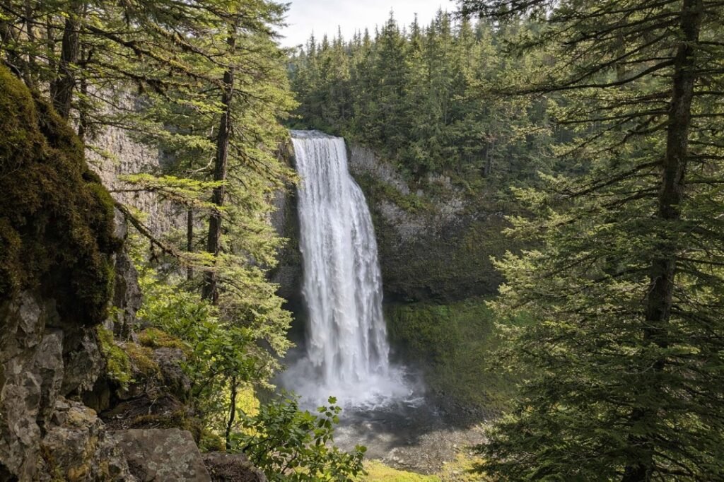
Location: Central Oregon, Willamette National Forest
-
Waterfall Type: Plunge
-
Height: ~286 feet
-
Trail Distance: ~0.5 miles round-trip (viewpoints)
-
Difficulty: Easy
-
Best Time to Visit: Spring through early summer
History & Background
Salt Creek Falls is one of the tallest and most powerful waterfalls in Oregon. The falls have long been a popular roadside attraction along the Willamette Highway (OR-58), drawing visitors for generations. The surrounding area was designated as part of the Willamette National Forest to preserve its scenic and ecological value, and developed viewpoints make the waterfall accessible while protecting the canyon below.
Geology
Salt Creek Falls plunges over a cliff of resistant volcanic rock formed by ancient lava flows in the Cascade Range. Over time, Salt Creek carved a deep canyon, creating the dramatic vertical drop seen today. The layered basalt and volcanic ash deposits exposed in the canyon walls reflect the region’s complex volcanic history.
Directions & Access
-
Nearest City: Oakridge, OR
-
Trail Information:
-
Short, paved paths to upper and lower viewpoints
-
Optional steep trail descends closer to the base
-
-
Parking:
-
Large parking area at Salt Creek Falls Day Use Area
-
Northwest Forest Pass required
-
-
Accessibility:
-
Upper viewpoint is wheelchair accessible
-
Lower viewpoints require stairs and uneven terrain
-
Best Time to Visit
-
Spring: Peak flow from snowmelt; extremely powerful and loud
-
Summer: Strong flow continues; easiest access and popular season
-
Fall: Reduced flow with fewer crowds and cooler temperatures
-
Winter: Snowy access common; viewpoints may be icy
Nearby Attractions
-
Diamond Creek Falls
-
Willamette Pass
-
Gold Lake
-
Odell Lake
References
-
Links:
-
Books:
-
Oregon Waterfalls by Greg Plumb
-
Waterfall Lover’s Guide: Pacific Northwest
-
Map
Sorry, no records were found. Please adjust your search criteria and try again.
Sorry, unable to load the Maps API.